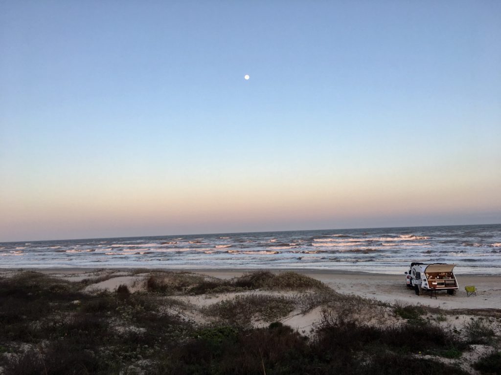
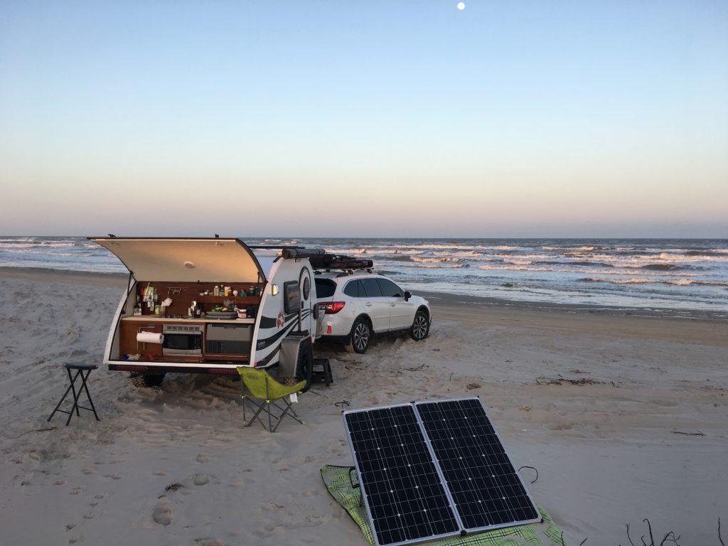
Solitude, warm nights, sea breezes, and a full moon in dark night skies create the backdrop for a Valentine’s Day beach getaway. In my opinion the best free winter beach camping in the country is at South Beach in Padre Island’s National Seashore.
“Bigger in Texas” Padre Island National Seashoreis the world’s longest stretch of undeveloped barrier island. The seashore creates the first break, or barrier, before the sea winds and water slam into the mainland.
Rugged, remote, and prolific ocean wilderness
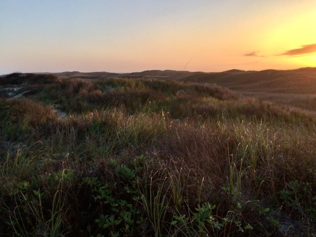
Coastline, dunes, prairies, and wind tidal flats are home to 380 bird species on 70 undeveloped miles of the preserve. You’ll see far more birds than people at this National Park.
All five species of Gulf sea turtles can be found on the island and surrounding waters. The Division of Sea Turtle Science and Recoveryworks to monitor and protect the turtles and is the only division of its kind in the National Park Service.
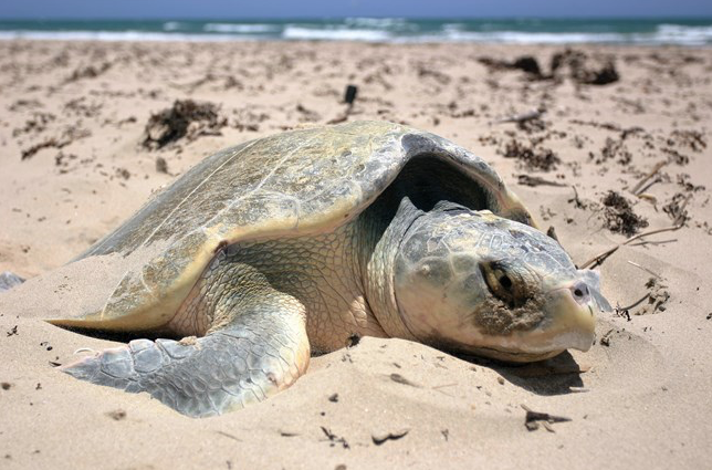
The endangered Kemp’s ridley sea turtle has safe nesting ground on these beaches and no effort is spared to save these turtles.
This is the setting for the best free winter beach camping in the US.
It Wasn’t Always So Beautiful

Four different nations have owned the expansive preserve on the Gulf of Mexico and none erected endless rows of condos. But the beaches and dunes had extensive damage from oil drilling and cattle grazing. Restoring the island to pre-European conditions became a goal in 1969. Two years later cattle were removed and Texaco paid for clean up of oil sites.
Today the mended island is a safe permanent and migratory home to Nature. And a perfect way to escape the city and hit the beach for free winter camping,
If you love isolation in Nature this is it. Almost.
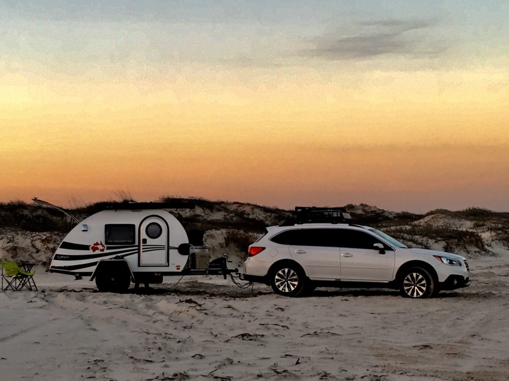
The beach is a public road! You can drive up and down much of the national preserve beaches and even primitive camp or boondock free on the beaches.
My favorite area is South Beach because it is less crowded than North Beach located just outside the National Park’s preserve system and the sand is more packed. It also has fewer mosquitoes than Bird Island.
How to Get to The Best Place to Boondock on Padre Island
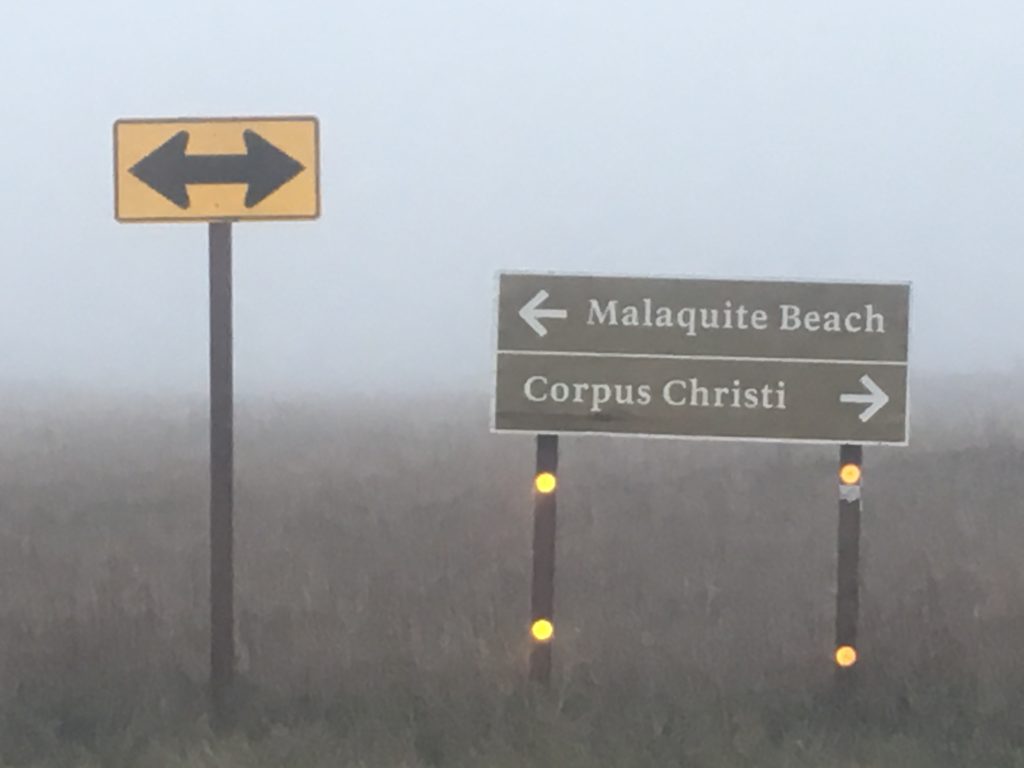
Take Hwy 358 southeast out of Corpus Christi. It becomes S. Padre Island Drive (SPID) and then Park Rd 22 and goes to park entrance directly. Entry fee is free with a National Parks Annual Pass or $10 per week. Be sure to register to camp at the entrance to South Beach at Padre Island National Seashore.
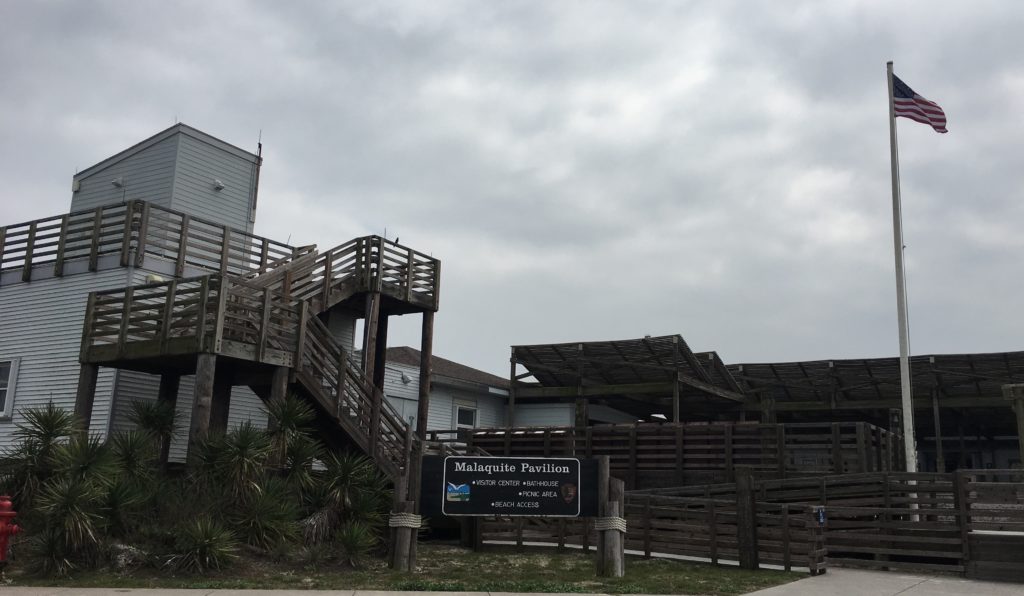
Stop at the Malaquite Visitor Center to get a copy of the tide tables and view exhibits of island history. Sign up for ranger led programs for birding and sea beaning. The center also sells ice and has cold water free showers.
Access to the south beach road starts at the park paved road just past the Visitor Center. The first 5 miles of South Beach are accessible by two-wheel drive. Beyond the first 5 miles South Beach goes on another 60 4WD ONLY miles before ending at the jetties at the Port Mansfield channel.
Tips for South Beach Driving and Free Winter Camping
This free winter beach camping is primitive and remote so come prepared with plenty of water, food, shelter, and mosquito spray. There’s little to no internet past the Visitor’s Center so be sure to make one final check of weather and tides while there.
Set up camp a minimum of 100 feet from the waters up to the edge of the white sand dunes. No camping is allowed in the dunes.
Just remember this is Texas public highway. Obey the standard laws – street legal, licensed, obey all traffic laws, speed zones, and remember to buckle up.
Because you’re gonna need to be strapped down to get to the perfect campsite. The sand road can disappear beneath surging waves forcing drivers closer to the soft, unpacked sand that can trap a car in seconds. Most of the road can disappear in high tide so plan accordingly or you’ll get trapped. Campers tend to set up in the 20-30’ section between the road and dunes.
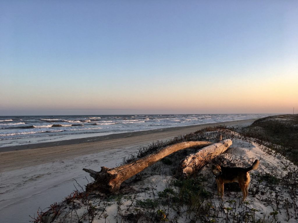
Small inlets created by eroding high tides can provide some break from the wind, but are also sand traps. Remember to look for a site 100 feet from the water and off of the sand dunes. Look for the high tide water mark and set up at least 10-15 feet above that mark. Factor in the anticipated tide level each day listed in the tide table forecast.
Be Prepared For The Unexpected
High temperatures in winter are usually between 50°-70°. The forecast was for low 50’s with sea fog. But the third night on my Valentine’s excursion a sudden, strong cold front barreled through. Gale winds blew and temperatures dropped quickly to the 30’s.
Rocky and I napped nervously through the irritable, howling night. Winds slammed logs in jams, created dunes around the rv, and forced sand into every possible crack and crevice. Even with the built-in stabilizer jacks deployed my rig swayed and lurched in high winds.
Morning awakened the rage of a winter storm that upended predicted tide levels. By mid-morning unrelenting brown waves thrashed each other in the race to shore. The ocean swallowed the beach road four hours before predicted high tide. My mouth dropped when waves began blowing into my cozy, sheltered cove at the edge of the dunes.
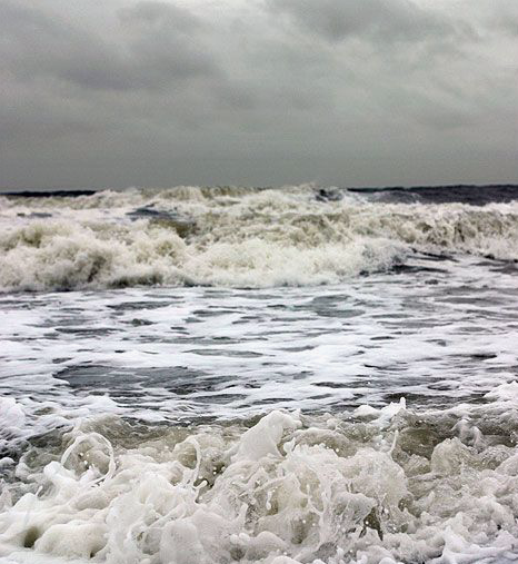
The power of the howling wind and rising waves roared like a tornado. Instinct grabbed control from my analytical mind still pondering how tide tables and weather forecasts could be as wrong as maps and GPS.
It didn’t take this plains gal more than two blinks to break camp, say a quick prayer, and drive nonstop through blowing wind, sand, and waves. Subaru’s all wheel drive combined with the offroad tires of my NuCamp RV made me howl with delight! Every time land slipped in surging water we quickly recovered forward progression.
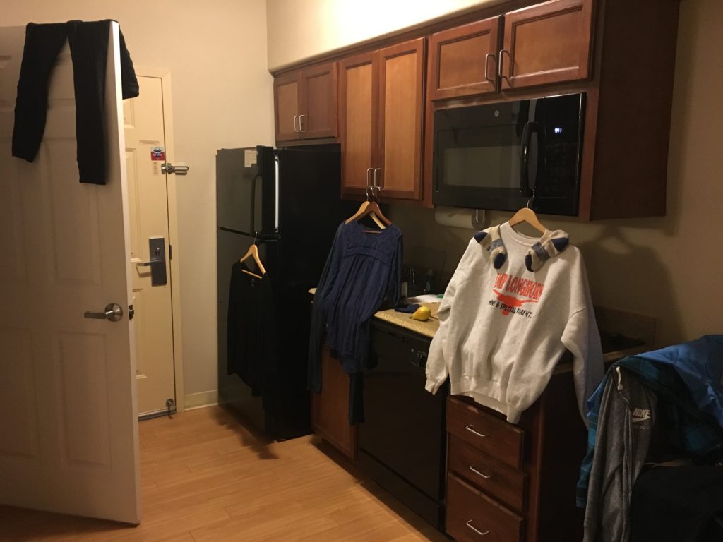
Malaquite Visitor Center was crowded with campers surprised by the sudden winter storm that brought coastal flooding and wind advisories. I didn’t hang around to contemplate my options. Instinct was still in charge and it drove me far inland before I realized the escape had left a mark. I had no trailer lights and it was dark.
Deal is, the best winter beach camping adventure can end like this and there’s only one thing to do. Check into a hotel, take a long hot bath, catch up on laundry, run camp dishes through the dishwasher and binge watch all the Crocodile Dundee movies!
Special Thanks for Your Help!
The fantastic folks at Custom Tinting and Truck Accessoriesfound and replaced the trailer hitch fuse shorted by seawater. They even taught me how to change the fuses myself. Good thing since shorting fuses outside of the standard auto fuse box is becoming a thing with me. Thank you for the great work Johnny Salazar and team in Victoria, Texas!

Fortunately the teams at AAA Premier RV and Subaru’s Extended Warranty programs will cover the unexpected hotel and food expenses while my vehicle was out of commission. These two programs pay for themselves every year that I’ve been on the road.
Go prepared. Stay flexible. Have fun!

 This All American Road has 11 amazing national or state forests, parks, monuments, and recreation areas. You won’t want to miss any! Each is a destination in its own right, so give yourself ample time.
 Spanning from
  time in a land that has shaped resilient, tenacious people. The range spans
 Vistas spanning hundreds of miles and eons of time offer a rare silence broken occasionally by the faint drone of airplanes. Sunrise and sunset delight the senses while expansive
  Scenic Byway 12 has two entry points.
 All American status
 A single lifetime is not nearly enough.
 Northern Wyoming and Southern Montana with hundreds of alpine lakes, steep headwalls, horns, cirque, and hanging valleys.
 Absaroka Range with steep slopes and stunning shapes amid long valleys.
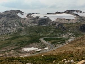 Combined these ranges create one of America’s most stunning visual masterpieces with infinite breathtaking vistas.
 you have any breath left after driving the thrilling twists and turns with steep drop offs on Chief Joseph Scenic Drive and the Beartooth Pass!
 is a top ranked engineering marvel and builder’s art.
 service roads, trails, campgrounds and boondocking sites.
 Be sure to take the
  While there, step back in time and experience how firefighters used the lookouts to fight fires in earlier days. Tools, maps, charts,
  and displays share the historical fire stories of these mountains. National Fire Service volunteers teach visitors about everything from fires to the oceans that once covered the region.
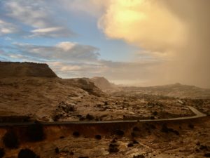
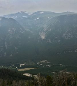 You can sure see the smoke in my story photos. I hoped to hold off on this blog until I could get clear photos of Beartooth Pass but I’ve never been to Montana when the skies were clear.
 I’ve learned that folks in the West talk about five seasons, the four we all know and Fire Season. Last year was a brutal record breaking fire season in Montana. So far in 2018 over 55,000 acres have burned in Montana and half of the counties are under air quality alerts.
 Experiencing the clear, big skies of Montana is still on my list. I’ve barely scratched the surface! Friends suggest rainy season in April and May. Winter is good but it’s a bit chilly with no heater. Rocky is a nice little heater but not that good!
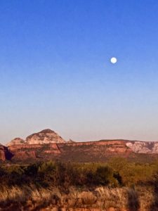
 But on Sunday Oak Creek Canyon reminds me of ants at a summer picnic. Sedona tourism has tripled in the last decade with over two million annual visitors. On any given weekend thousands pack the roadway, parking lots overflow both sides of the highway, and bumper-to-bumper one-lane traffic inches through the gridlock. The highway flows into downtown Sedona and every artery is an organized bottleneck thanks to abundant roundabouts.
 Take HW 89A west from Sedona to mile marker 365. Turn right on Forest Rd 525 – Red Canyon Road. From entry to Palatki Ruins are many clearly marked pullouts. Some can accommodate numerous rigs while others are perfect for a small tent.
 Mongollon Rim with Secret, Bear, and Lost Mountains on the east and Black, Sugarloaf, and Casner Mountains on the north and west.
 Like all of Sedona it can get crowded and it’s worth venturing past the first spots. The area has many
 that seem close enough to touch.
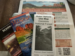

 National Forest campsites are larger than the
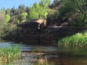
 It can accommodate small RV’s and tent campers on acres of open pasture and forested shade. Rates range from $20-$35/day. Camp Avalon is located at 91 Loy Lane in West Sedona off of 89A. Reservations available at
  The hiking trails of Sedona are some of the nations best so it’s worth the realities of camping in a heavy tourist area. The
