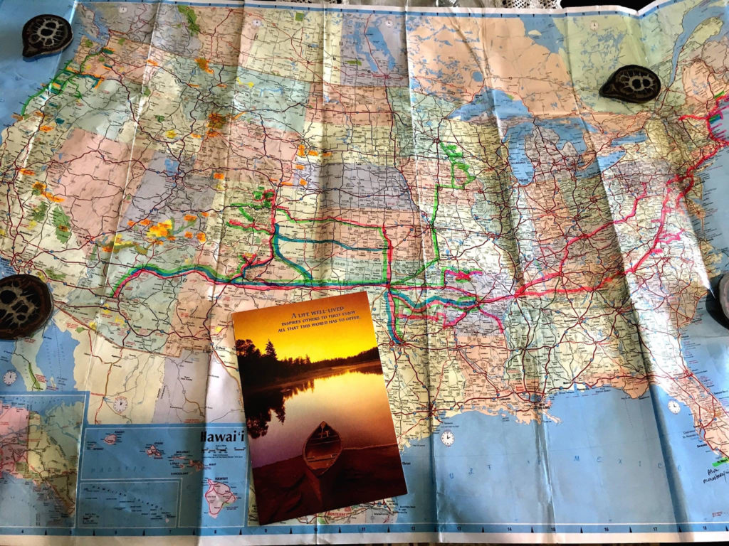
The beauty of nomad life is the ability to pack up camp and leave. Unexpected weather change can usually be handled with a move on down the road. But the deal is, “unpredictable” is the new weather norm. High winds, flooding, and snow are sweeping across the country much like the fires do in the summer. By the time you travel to forecasted clear weather and set up a camping site the winds shift bringing strong storms.
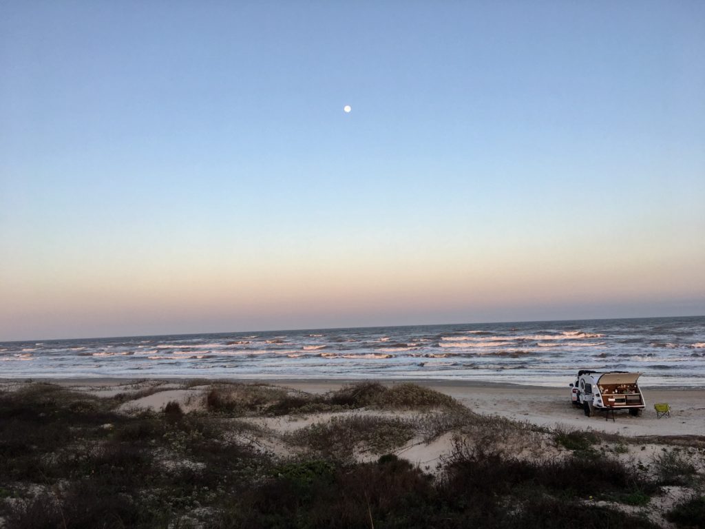
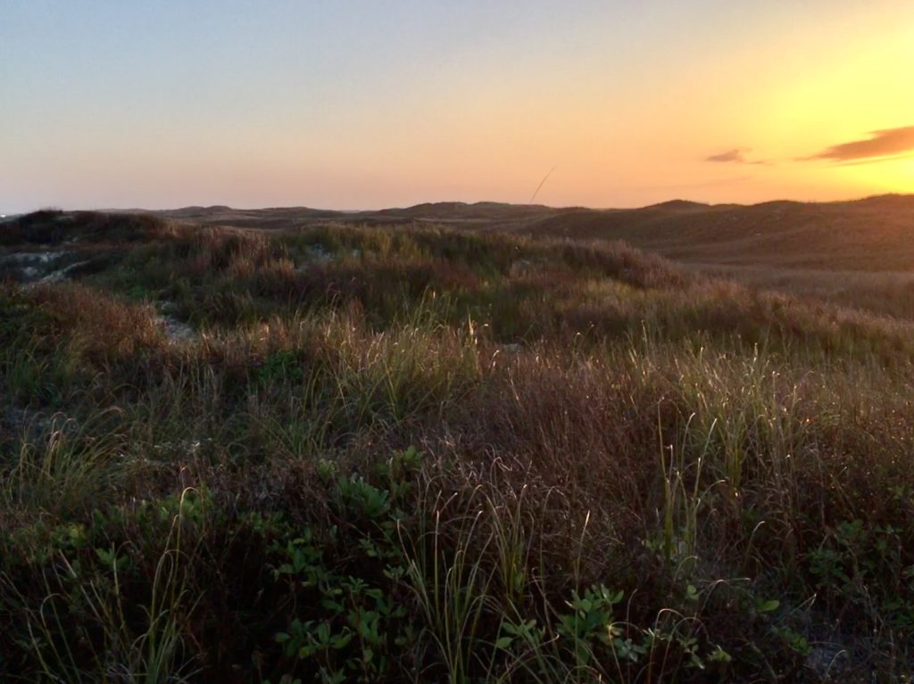
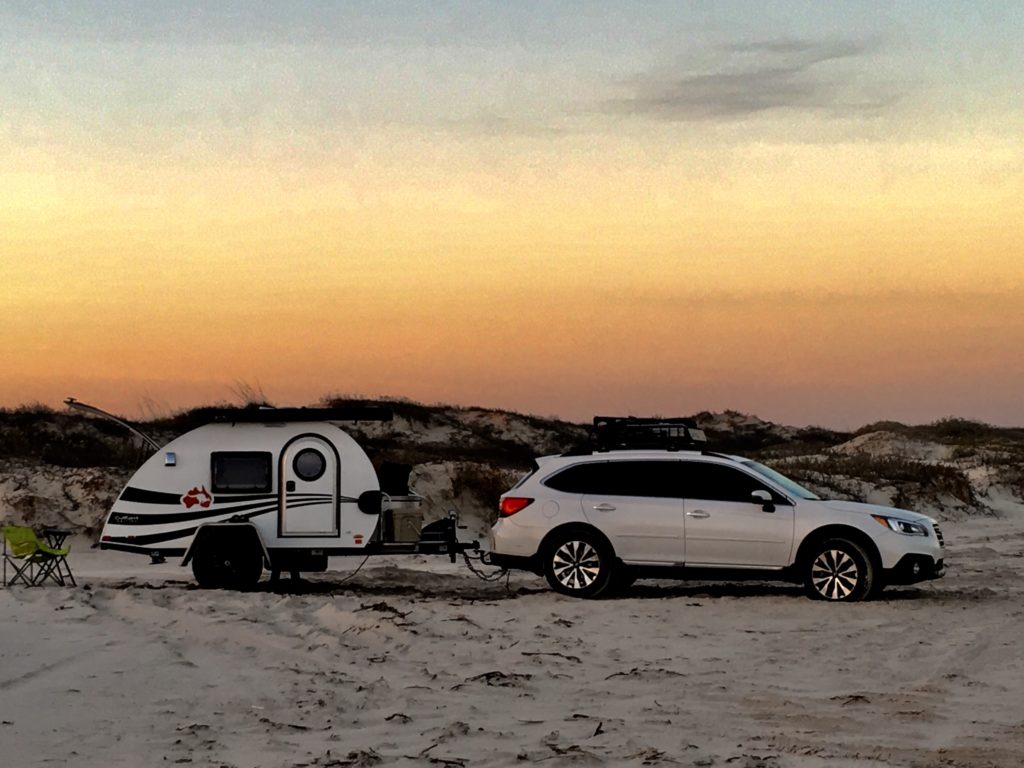
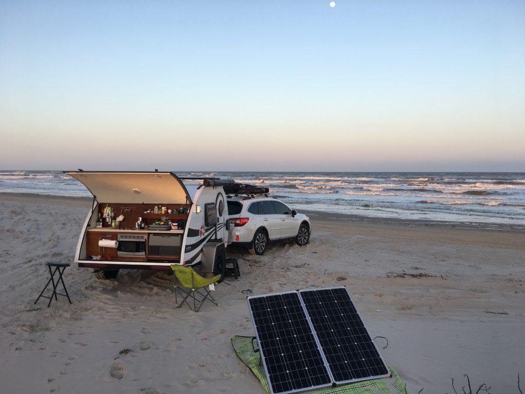
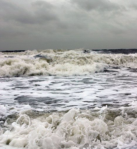
This month I traveled to the south and central regions of Texas because of historic snowstorms in the traditional winter havens in Arizona and California. When my beach camp on South Padre Island Beach Preserve disappeared under unexpected storm waves and strong winds I instinctively headed to the woods for protection.
Shelter in the Forest

One of the closest and most beautiful places to shelter in the forest from the starting point of South Texas
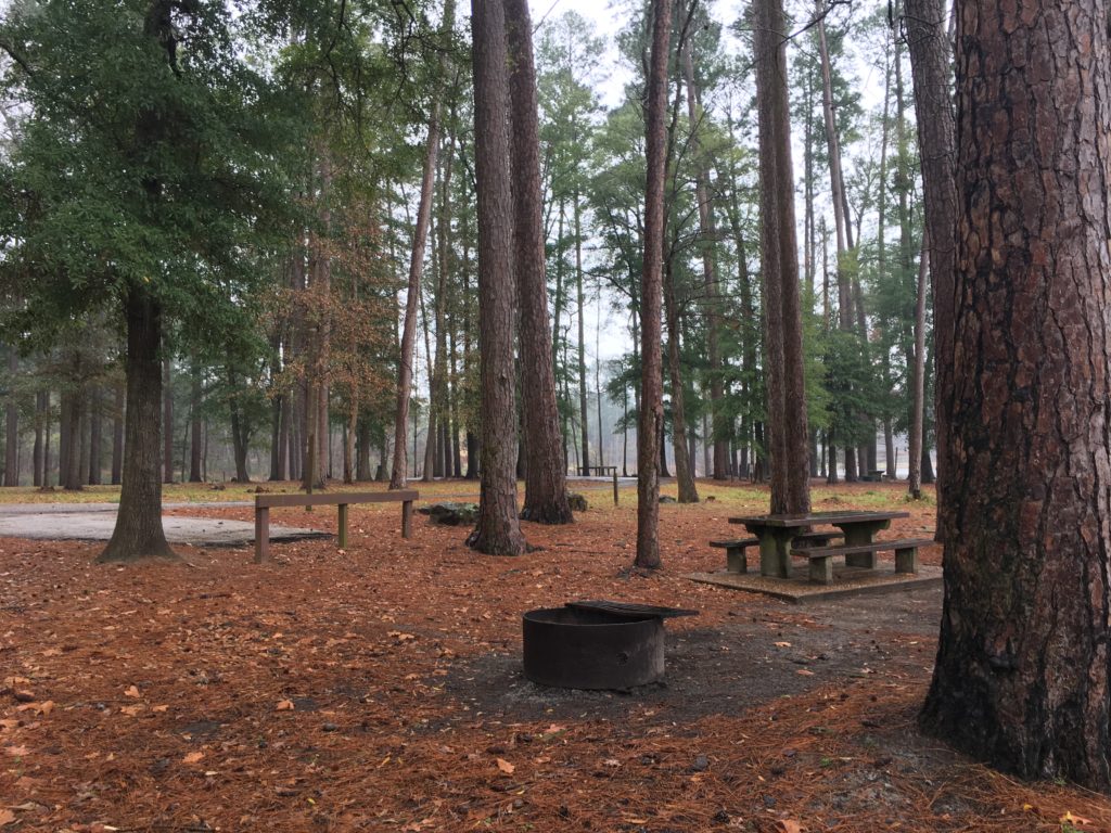
Young loblolly pines are maturing in forests of oak and beech surrounding old logging lakes. Hiking trails meander through abandoned homesteads, mills and buildings erected for trail life during the 1900-1920’s lumber boom. Spacious, impeccably maintained and monitored campground facilities meet every need.
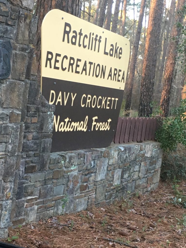
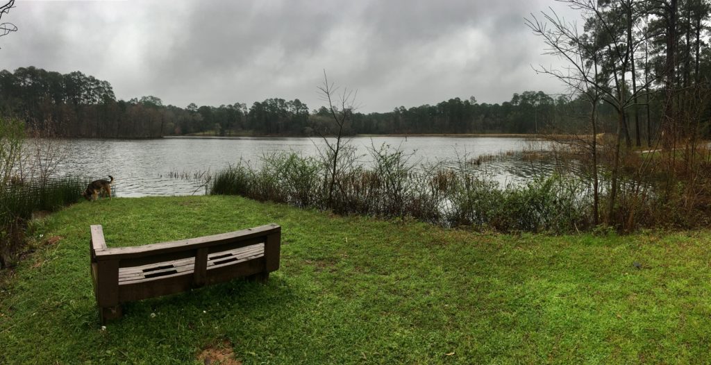
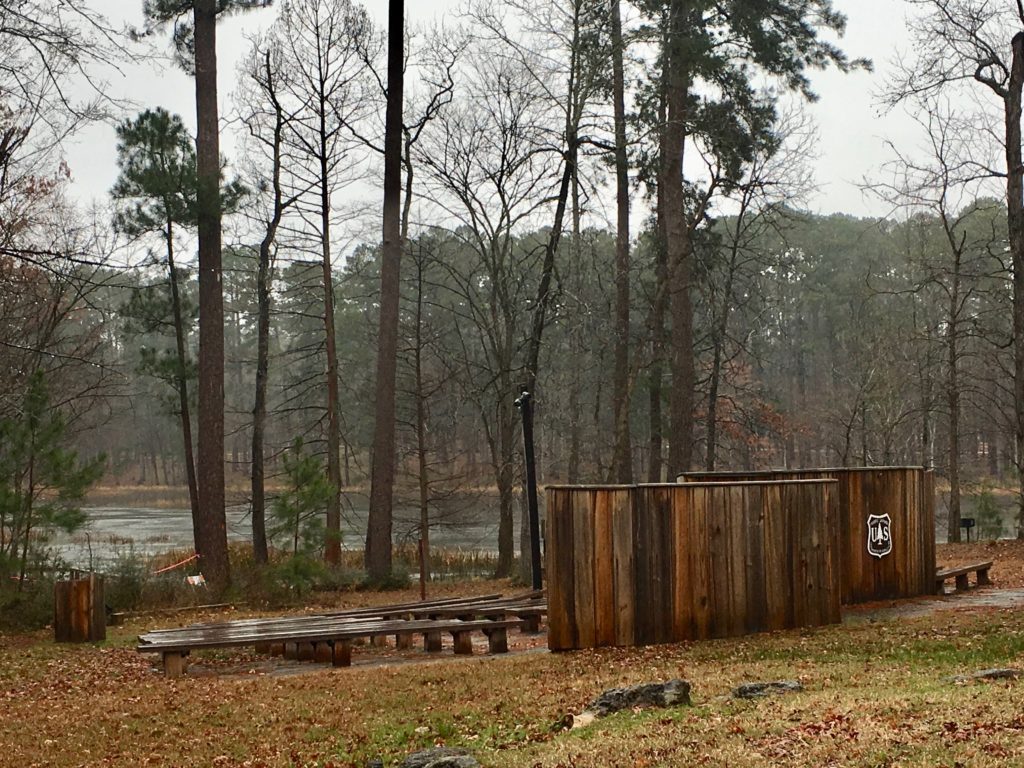
Ratcliff Lake Recreation Area in Davy Crockett
I was drawn to Davy Crockett rather than Sam Houston, Angelina, or Sabine National Forests because of a childhood memory of the Davy Crockett TV show. Driving from Southern Texas Hill Country north to Austin then east to Houston that song looped in my mind along with images of the beautiful rolling hills and forests featured in the old black and white TV show of the “King of the Wild Frontier” Davy Crockett.
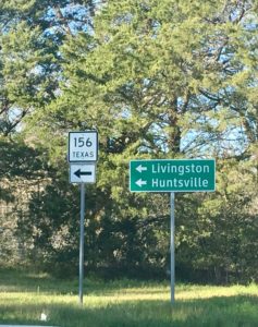
I settled into the Radcliffe Lake Recreation Area in the national forest just outside of Lufkin and Kennard Texas after a long day of driving interstates across Texas.
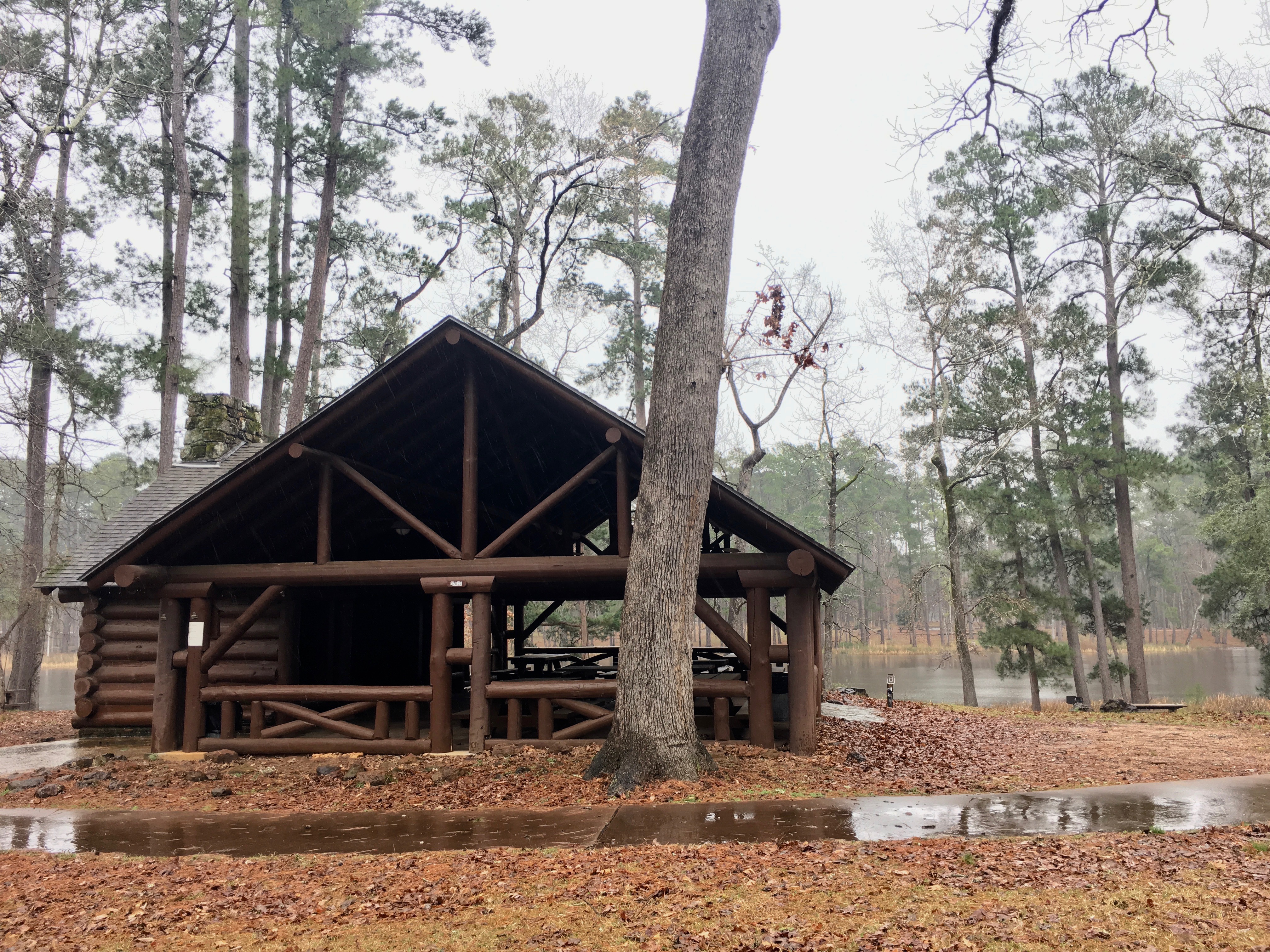
The Civilian Conservation Corp (CCC) built the camp in 1936 and preserved all the charm and character of that era.
Campground Ammenities
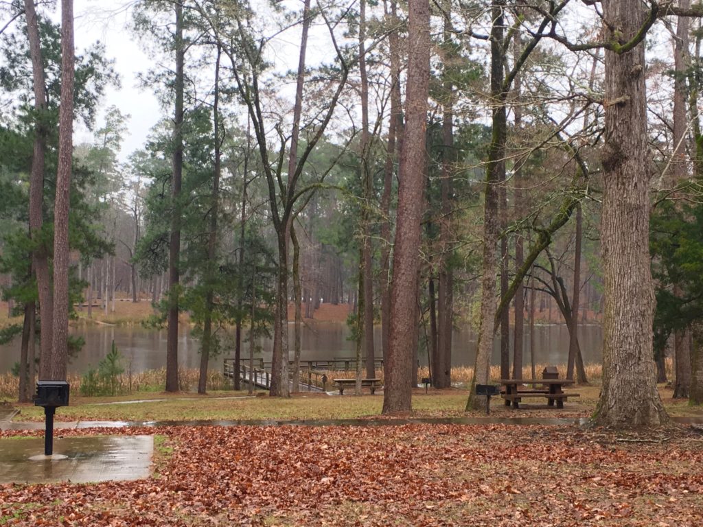
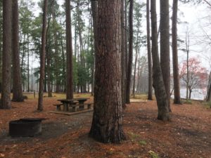
The grounds stretch around the small 45-acre lake with ample room between sites and plenty of electric and plumbing services to pamper campers. There’s also space preserved in gorgeous locations for walk-in, primitive tent camping.
In fact, the fingers of the Lakeside and Loblolly Loops have a tent group campsite on the point of a neck of the lake surrounded by several large primitive camping sites. There are ample potable water outlets on the loop.
It’s a good on-grid experience for us boondockers who camp only during the week, if ever, in an established campground.
Long History As Gathering Place

Imprints from centuries of life in the forest flow from early Native American settlements to a booming logging business at the turn of the century and now, to today’s small, beautiful, and peaceful on-grid campground.
It’s easy to feel the layered generational memories from pow wows and large family camping reunions to intimate couple getaways or friends gathering for fishing and campfire getaways.
Facilities for Groups
An amphitheater and two large sheltered picnic pavilions facing a roped-off swimming area vibrate with the history of weddings, revivals, church services, and easy, simple fun. There’s fishing, swimming, and boating on the quiet lake. Boat motors are not allowed. The icing on the cake? A concession area similar to a church kitchen. Can we say reunion?
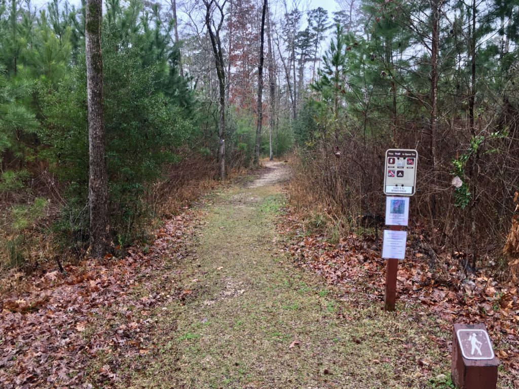
Hiking Trails
The camp is enveloped by over 160,000 acres of national forest. The 20-mile Four C Hiking Trail explores lower and upper pine and hardwood forest, boggy sloughs, and upland bluffs with scenic overlooks. The Big Slough Wilderness on the route has abundant wildlife and primitive campsites for backpackers.
Nearby History
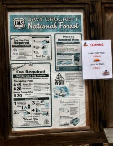
Check out local history at the CCC Camp-888’s reconstruction of the 1690 Mission Tejas chapel north of Ratcliff on State Route 21. A few miles further north showcases Native American history at the Caddoan Mounds State Historical Park.
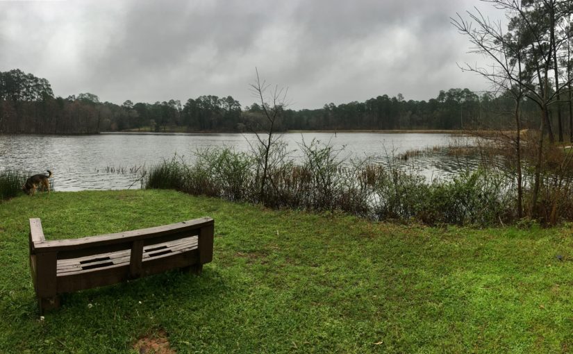
My Experience in Ratcliff Recreational Area
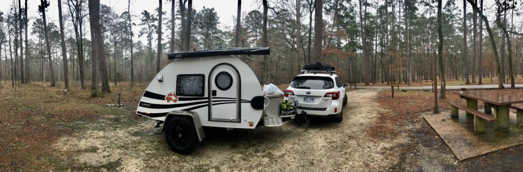
I arrived at Ratcliff camp in a shroud of mist seeping through the humid forest. Sunset colored the hovering fog over the lake. The site I selected backed up to the woods at the far edge of the campground. During the week there were only three RVs in the entire water and electric hook-up loop and only one tent camper down by the lake.
Shelter from the Storms
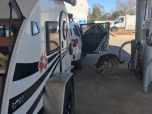
I was so grateful to be out of the shifting sands and pummeling winds and waves of the beach storm! The abundant wildlife, rustling pines, and tree frogs in the pines created the perfect soundtrack for the vista of gently rolling forested hills. A soft fog enveloped our teardrop nestled in the pines as Rocky and I settled in for a deep, hard sleep.
We woke to a steady but gentle rain. A
My Gut Said ‘Move On’
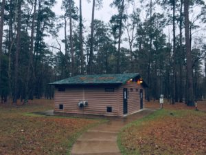
In spite of the beauty, electric and water hook ups, and clean bathrooms with real flushing toilets and hot showers I couldn’t settle. My gut pressed me to move camp after hiking. I would rather snuggle in with a good book on a cold, rainy afternoon nestled in a gorgeous forest than act on nomadic instincts.
Nevertheless, b
I popped onto Wi-Fi during my first break for gas and received a text alert for severe weather in the Daniel Boone National Forest where I had camped. Unexpected, strong storms hit suddenly. It ended up lasting two days. Roads closed due to flooding.
Searching national forecasts to find
Home Sweet Home
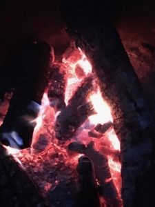
I’m grateful to be sharing this particular tale in front of a roaring fire in my home base in Norman, Oklahoma where we have freezing rain and snow in the forecast.
My teardrop is packed; gas tank is full and ready to go. My nomad gut is feeling a tug from southeastern Arizona. Fortunately my overly analytical brain is keeping my gut snoring gently by the fire’s warm glow.
For now…


 raspberry meadow on the roaring creek in the shadow of Crystal Peak outside Hill City, South Dakota. But I respect the other wanderers who fill the places I free up, so I sang travel songs and prayers into my pack and headed north to Big Horn country.
 grow deeper, faster, longer. Twenty square acres can offer snow-capped mountains, hills rolling into wide prairie valleys dropping to canyons laced with crystal streams, waterfalls, and roaring rivers. The entire universe can exist in one alluring square inch.
 There is also comfort in the northwest summer temperatures. Unlike the South’s wet sweat lodge heat, it’s quite simple to find cooling shade in the northern trees and bluffs. A nearby icy creek, river, or lake can relieve even the worst heat of the day and evening breezes bring the perfect chill for snuggling in.
 Social and sacred gathering sites like Medicine Lodge outside Hyattville, WY invoke feelings of going to grandma’s – on steroids. The bluff along Medicine Lodge Creek has been a gathering place spanning 10,000 years from Paleoindians to the Crow people. Each left a mark, a lesson, a sharing across the bluff’s 750-foot mural.
 Figures have been pecked, incised and painted by artists representing at least 60 different northern plains groups. The diversity and quality of the figures makes this massive mural one of the major rock art locations in the region.
  Late Prehistoric Period hunter-gatherers created most of the petroglyphs. Local tribes of Crow and Shoshone made the recent art during the 1700-1800’s. The work captures every single known, recorded figure of the northern plains artists.
 sage, and sweet grass. Medicine Lodge nurtures solo journeys where protective filters dissolve and the soul opens to sing, dance, pray, and play with the Universe.
 GPS is my only hope in the city. But the more the on-grid networks fade, the more I hear, see, feel, smell the way like I did as a child. It is simple but not easy to remember the way always shows up when I have exhausted all of my skills and let go of my planned outcomes. The way waits for me to ask and wraps me in sweet encouragement and obvious signs leading me to where I’m meant to be.
 I won’t try to use words to define the shelter of Medicine Lodge because it seems insulting to try to contain flow. I can assure you it is worth losing yourself to the Bighorn. May you and yours know the peace, grace, and welcome that appears when lost is found.
 But on Sunday Oak Creek Canyon reminds me of ants at a summer picnic. Sedona tourism has tripled in the last decade with over two million annual visitors. On any given weekend thousands pack the roadway, parking lots overflow both sides of the highway, and bumper-to-bumper one-lane traffic inches through the gridlock. The highway flows into downtown Sedona and every artery is an organized bottleneck thanks to abundant roundabouts.
 Take HW 89A west from Sedona to mile marker 365. Turn right on Forest Rd 525 – Red Canyon Road. From entry to Palatki Ruins are many clearly marked pullouts. Some can accommodate numerous rigs while others are perfect for a small tent.
 Mongollon Rim with Secret, Bear, and Lost Mountains on the east and Black, Sugarloaf, and Casner Mountains on the north and west.
 Like all of Sedona it can get crowded and it’s worth venturing past the first spots. The area has many
 that seem close enough to touch.

 National Forest campsites are larger than the
 It can accommodate small RV’s and tent campers on acres of open pasture and forested shade. Rates range from $20-$35/day. Camp Avalon is located at 91 Loy Lane in West Sedona off of 89A. Reservations available at
  The hiking trails of Sedona are some of the nations best so it’s worth the realities of camping in a heavy tourist area. The


 Home to abundant wildlife, wild grasses, hardwoods and evergreen junipers, the canyon also holds the memories and artifacts of 12,000 years of human habitats. A little over 200 years ago the native Southern Plains tribes were decimated and relocated to reservations in Oklahoma. Wild buffalo were slaughtered to make way for a few white barons and their herds of longhorn cattle.
 This is a great state park in winter, spring, and fall. (Summer heat and humidity can be a bit much.)
 vegetation for shade and privacy. Abundant wildlife gathers at the creek running along the cliffs at the back of the canyon.
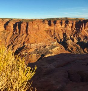
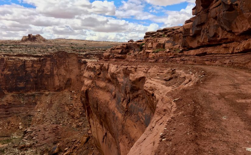
 The heart and soul of the Colorado Plateau in southern Utah is expressed through canyons, arches, spires, and mesas carved by the Green and Colorado Rivers.
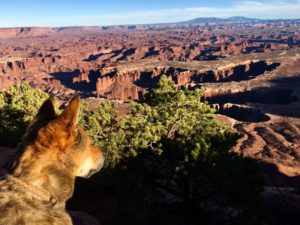 It’s almost impossible to wrap my mind around so much stunning beauty but it is as natural as breathing to allow all of that to become all of me. In my prayers and practices it also flows to each of you.
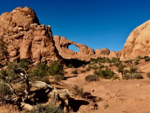 Inside both parks there is no food, gas, or other amenities. Each has one national parks campground.
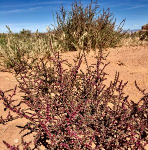 and animals still live in much of this remote, rugged, and wild countryside. Lots of folks call it “The American Wild West” but it’s been around much longer than we have and God willing will continue long after we’re gone.
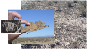
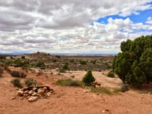
 A thin, fragile veneer of biological soil crushed by your footprints alone (compression) may require five to seven years to recover. Cyanobacterial growth can take 50 years and lichens/mosses even longer.
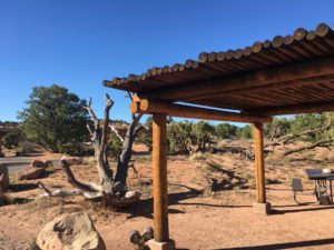
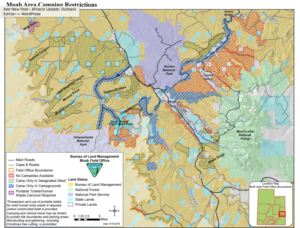
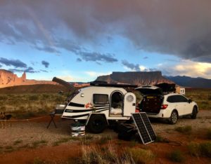
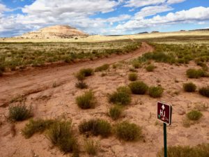
 The Moab BLM Field Office manages over two million visitors annually on 1.8 million acres in the heart of the Colorado Plateau.
 Weather can make unpaved roads impassable. Check with rangers for latest conditions.
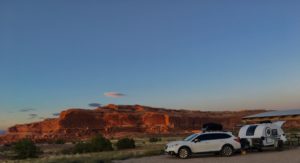 Lone Mesa Group Camp
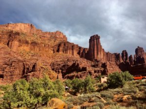

 Hardscrabble – South of Hardscrabble Bottom
 Murphy Hogback – near Murphy Point trails
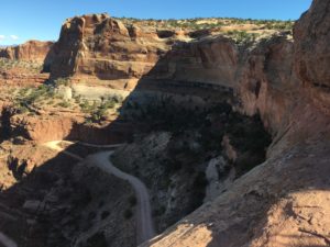
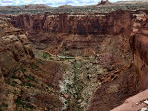 Narrow, ridiculously steep grade, no safety rails and the most amazing, adrenaline-inducing experience calling my name! The Subaru and teardrop had torn up off roads for days and I was primed for the grand prize dive down The Canyon.
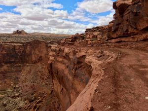 Perhaps a bit of recon was in order. Rapid, shallow breathing and heart-pounding adrenaline with knees bent, eyes straight ahead helped resist the abyss tractor beam pulling me over the edge on the switchback curves. Barely. There was just enough width for the car and RV. No margin for error, changing my mind or turning around. There might be a clearance and mud issue. But I was a hound dog on a scent. Ride The Canyon or bust!
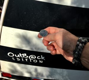 Time to pull out the big guns and use a technique honed over eight years in the halls of MD Anderson Cancer Center. Call in my angels when stakes are life OR death high. Employ the hallowed Coin Toss. Best two out of three wins. Heads means I go for it, tails I turn around and find a camp for the night.
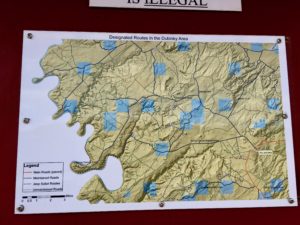 My best guess is I was in the Sheep Canyon area. GPS noted Mineral and Dead Horse Point Roads. I found an OHV trail map sign post indicating I was somewhere in the Dubinky area. Maybe The Canyon was a piece of Hell Roaring or Chicken Corners Trails. The coin toss occurred at the point requiring gate entry, is pinched between rocks on the right and the abyss on the left and drops over 1,000 feet via narrow, rocky, muddy switchbacks. Chicken Corners is where Moab area guides allow “chicken” passengers to walk, rather than ride. And Hell Roaring Canyon descriptions involve the word “pucker.”
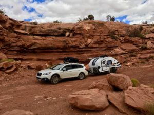 I probably have too much faith in Beverly (my Subaru Outback) but I think she’d make The Canyon. Pulling my Outback teardrop camper affectionally dubbed Hillbilly? Sheer lunacy.